Services
Mapping and Data Acquisition Services
Accurate and Reliable Data Acquisition is the foundation of effective geospatial solutions. NeoGeo offers a comprehensive suite of mapping and data acquisition services designed to meet diverse project requirements. Leveraging cutting-edge technologies, our solutions empower organizations with precise spatial data for informed decision-making and optimized operations.
- High-Resolution Aerial and Satellite Mapping: Capture detailed imagery from satellites and aircraft, providing comprehensive spatial coverage for infrastructure planning, urban development, and environmental monitoring.
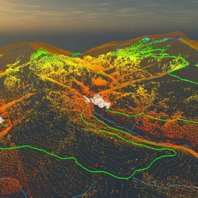
- LiDAR Surveys (Airborne, Terrestrial, Mobile): Use LiDAR technology to generate high-precision elevation data, suitable for terrain modelling, asset mapping, and risk assessment.
- UAV/Drone-Based Surveys: Deploy drones for rapid and cost-effective data collection, enabling site inspections, volumetric analysis, mapping inaccessible areas and land information management.
- Photogrammetry and 3D Mapping: Transform 2D imagery into accurate 3D models for land surveys, construction planning, and heritage site preservation.
- GPR Surveys: Employ Ground Penetrating Radar for subsurface exploration, ideal for utilities mapping, archaeological studies, and geotechnical investigations.
- 360-Degree Video and Attribute Surveys: Combine immersive visuals with attribute data to enhance asset management, road condition assessments, and public infrastructure planning.
Modelling and Data Processing Services
NeoGeo specializes in advanced data processing services that transform raw spatial data into actionable insights. Our comprehensive solutions ensure accuracy, scalability, and seamless integration, catering to diverse industries and project needs.
- Spatial Data Processing – DEM, DTM, DSM, 3D Mesh: Create accurate terrain and surface models, including Digital Elevation Models (DEM), Digital Terrain Models (DTM), Digital Surface Models (DSM), and 3D meshes, supporting infrastructure design, flood modelling, and urban planning.
- Digital Twins: Develop dynamic, real-time replicas of physical assets or environments for predictive analysis, scenario planning, and operational efficiency.
- GIS Database Design and Development: Design and build robust GIS databases optimized for spatial analysis, ensuring efficient data storage, retrieval, and management.
- Enterprise GIS Implementation: Implement GIS solutions at an enterprise scale to centralize spatial data, streamline workflows, and enable better decision-making across organizational functions.
- GIS Hub/ GIS Lab Creation – Spatial Data Infrastructure (SDI) Design: Establish centralized GIS hubs, GIS labs and SDIs (CORS – implementation and support) to facilitate data sharing, collaboration, and governance across departments and stakeholders.
- Geospatial Data Conversion and Integration: Convert and integrate data from various formats and systems into unified geospatial platforms, ensuring compatibility and usability.

Geospatial Analytics
NeoGeo’s Geospatial Analytics and Remote Sensing Services offer actionable insights by leveraging advanced spatial data interpretation techniques. From predictive analytics to environmental assessments, our solutions help industries make data-driven decisions for sustainable and efficient operations. NeoGeo combines geospatial expertise with cutting-edge analytics, empowering clients to address complex challenges and unlock the full potential of spatial intelligence.
- Predictive Analytics with Geospatial Data: Utilize network and proximity analysis, terrain modeling, and climate impact assessments to anticipate trends, optimize resource allocation, and support planning in infrastructure, disaster management, and environmental conservation.
- Data Interpretation – EO and SAR: Analyze Earth Observation (EO) and Synthetic Aperture Radar (SAR) data for detailed insights into surface patterns, vegetation health, hydrology, and urban dynamics, enabling precise monitoring and decision-making.
- Land Use and Land Cover Mapping/ Change Detection Analysis: Provide detailed land classification and monitor changes over time to assess urban growth, deforestation, and agricultural patterns, facilitating sustainable land management.
- Thermal and Infrared Analysis: Perform thermal imaging and infrared studies to monitor heat signatures, identify anomalies, and assess energy efficiency, making it essential for sectors like utilities, agriculture, and environmental studies.

Training and Capacity Building Services
NeoGeo’s Training and Capacity Building programs are designed to empower individuals and organizations with practical knowledge and advanced skills in geospatial technologies. Our offerings include tailored courses for diverse audiences, from beginners to seasoned professionals, ensuring proficiency in GIS, remote sensing, and customized applications. The training programs blend theoretical knowledge with practical implementation, fostering a skilled workforce ready to drive innovation and efficiency using geospatial technologies.
- GIS and Remote Sensing Training Programs: Comprehensive programs covering fundamental and advanced concepts in GIS and remote sensing, including spatial analysis, data processing, and remote sensing techniques. These courses are ideal for students, researchers, and professionals seeking to build core geospatial competencies.
- Certification Courses for Professionals: Industry-recognized certification courses designed to validate expertise in specific geospatial domains. These certifications enhance professional credibility and career prospects, providing hands-on training aligned with global geospatial standards.
- On-Site Training for Custom Applications: Tailored training sessions delivered at client locations, focusing on organization-specific geospatial applications. These sessions ensure teams are equipped with the skills needed to leverage GIS and remote sensing tools effectively for unique operational challenges.