NeoGeoInfo has done this project For Board of Revenue for Rajasthan, Ajmer under project entitled “Digitization of Cadastral Maps / Revenue Maps And Integration with Revenue Records across the State of Rajasthan”.
Type of service
Digitization of Cadastral Maps / Revenue Maps and Integration.
Scope of Work
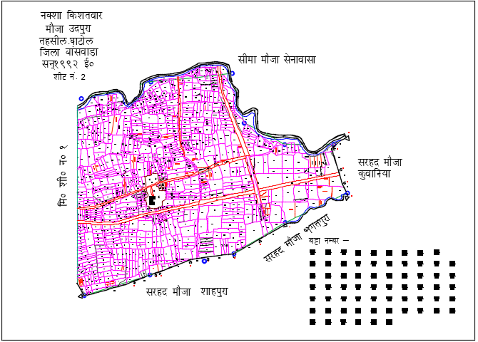
Digitized Village Map Sheet
Collection of hardcopy of map sheets from District Land Record Offices across the State
Scanning of Village Map sheets
Image Cleaning, Indexing & generation of check prints on micro transparency with 100%
Matching on 1:1 scale output.
Digitization of scanned Village map sheets.
Edge matching of sheets within a village in vector format
Providing Vector Data and hardcopy plots
Imparting training of computer applications
Output Format
ARC .shp or ARC Geo-database file format. Format dwg/ dxf/ ESRI etc. Software
Standard GIS software compatible format.
Objective of the project
Digitization of village Cadastral (revenue) maps and its linkage with textual data i.e. RoR (Records of Rights) etc is envisaged to provide the services related to land records and monitor revenue administration across the state in order to improve the administrative processes.
DIGITIZATION OF CADASTRAL MAPS is to digitize cadastral maps in the State and linking of the same with textual data (RoR) and more services will be extended to the citizens. As of now, e-Dharti (ApnaKhata) is being used in Rajasthan for maintaining the RoR (Record-of-Right).
Cadastral maps in digitized form and the same would be linked into the existing land records software. This would streamline the land revenue administration as the system would be temper proof with high availability of data in the Tehsils/ Sub-Divisions/ Districts/ State/ Common Service Centre (CSC) after linking of digitized cadastral maps with the textual data.
The digitization of village (revenue) maps will help State Government to create database of the revenue maps/ mother-maps in digitized form and will get linked up with the existing database of Land Records Management Software e-Dharti (ApnaKhata) developed and maintained by National Informatics Centre, Rajasthan. Average no. of map sheet is 100000 (approx) sheet and parcel no of per sheet 200-600 (average) , however, the Khasra nos. may increase after updation.
Achievements/ Results
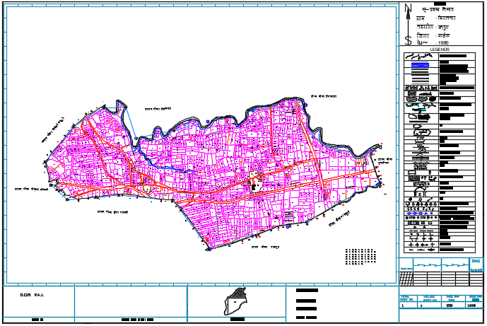
Final Digitized Map
Geoinfosys Technologies has successfully completed in Eight District of Rajasthan and this project is running smoothly.